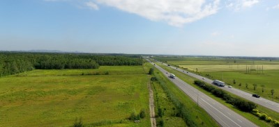
The Lands Unit of the Mohawk Council of Kahnawà:ke (MCK) is pleased to announce the release of the Lands Designation Working Group (LDWG) recommendations report, detailing the results of the community consultation on the returned lands located along Highway 30 and Old Chateauguay Road.
The consultation was led by independent consultants Neil McComber and Louise Mayo, guided by the central question: “What would you do with over 500 acres of land?” From February 11 to March 31, 2025, more than 500 community members participated in consultations through mapping activities, focus groups, engagement kiosks, and one-on-one appointments to designate nearly 540 acres of returned land across Parcels A, B1, B2, C, D, and E. The results were formally presented to the Lands Designation Working Group in April.
Earlier in 2025, findings from a feasibility study conducted by Groupe BC2 were shared with community members during the consultation. The study showcased the potential constraints for each land parcel in regard to land use, preliminary soil characterization, infrastructure, access, and socio-economic data.
Building on this, the final recommendations report integrates the consultation findings with feasibility data, environmental assessments, and the technical expertise of the Lands Unit technicians. The completed report was presented to the Council of Chiefs on Tuesday, June 24, 2025.
“This process was not only about listening and making sure the land speaks to the needs of future generations but incorporating what was actually suitable based on the feasibility study and the community engagements,” said Veronica Leborgne, Director of Lands and LDWG member.
Overall, the LDWG’s final recommendations are fairly close to community feedback. Collectively, conservation ranked as the highest priority, followed by residential and then commercial designations.
“We are sincerely grateful to all community members who shared their time and ideas throughout this process,” said Neil McComber, Lead Consultant for the project. “The community gave thoughtful, honest input, and it was our job to reflect that as accurately and respectfully as possible.”
The next step in the process will involve presenting the report and proposed land designation map to the community through a series of in-person sessions that will serve to both inform and validate, allowing community members to review the results, ask questions, and share any additional perspectives.
It is important to note that the designations are not development plans. They are meant to serve as a framework for potential future land use planning. Any development on these lands will require further engagements and studies, including environmental and archaeological assessments. The full report is available online for public viewing here.